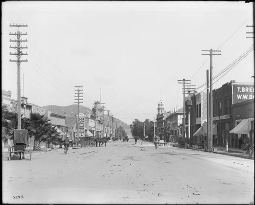
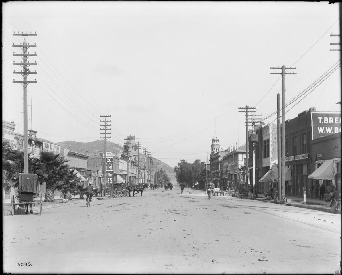
A view of Eighth Street in Riverside, looking west with Mount Rubidoux in background, ca.1900
Georeferenced
Current Georeference
Image Details
- Source:
- University of Southern California
- Collection:
- California Historical Society Collection, 1860-1960
- Date:
- circa 1900
- Description:
- Photograph of a view of Eighth Street in Riverside, looking west with Mount Rubidoux in background, ca.1900. Horse-drawn vehicles are parked along both sides of the dirt street, while others travel up and down the street. The street is busy with pedestrian, bicyclist, and horse-drawn carriage traffic. Most of the buildings are commercial and about two-stories high, with the exception of a clock tower (at left) and a cathedral (or church) at right, which stands about three-stories tall. Utility poles line both sides of the street. At right, there appears to be some construction work and digging in progress near the sidewalk. The dirt road is littered with horse manure(?). Legible signs include: "Davenport Bros", "Tinning, tel. black 261", "box ball", "xxxx", "Tally Ho Livery, feed & sale stables", ..."JHD Cox"..., "[...] Younglove, oi[...], feed, fuel", "[...] Co., [...]ve, prop, [...]line", "[...] Elder, [...]ries", "carpenter shop", "[...]eries", "Michelbacher", "storage and commission", "lunch", "Ramace", "T. Bre[...], W.W. B[...]".
- Source:
- Loading...
- License:
- Public Domain Mark
- Rating:
Georeference Details
- By:
- Josiah White
- Date:
- Jun 16, 2026
- Total:
- 1 submission
- Confidence:
- High
- Validations:
- 0
- Notes:
-
Livery visible on 1908 Sanborn map
Actions
This image has been georeferenced. Login with OpenStreetMap to submit a correction.
Image Subjects
Timeline
All georeferencing activity and comments for this imageGeoreferenced by Josiah White Current
Jun 16, 2026 7:07 PM
33.980962, -117.372491
299°
High Confidence
0 validations
Livery visible on 1908 Sanborn map